Appendix – Delaware River Flood Crests
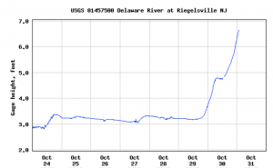
 The Delaware River, like most others, is measured in depth at United States Geological Service (USGS) gauging stations, generally located at or very near major bridge crossings along its length. Because these depths and the banks that surround them differ, so do flood stages at each station, although some are similar. Another factor affecting actual flood crests at any point along the river is the elevation of surrounding land: where banks are higher, flooding will be less severe.
Delaware River Stream-Flow Gauging Stations
Water years run from October 1-September 30, and are designated by the ending year.
[jtrt_tables id=”585″]
Peak Water Levels During Flood of Aug. 19-20, 1955
[jtrt_tables id=”589″]
(ANL = Above Normal Low)
SOURCE: 1955 Annual Report – Delaware River Joint Toll Bridge Commission